Camp Dubois to the Pacific · 14 May 1804 · The Corps of Discovery
Ocian in View! O! the Joy
Thirty-three explorers rowed, hauled and climbed across a continent to the Pacific, then came home with the first true map of the American West.

The moment · 7 November 1805 · Columbia River
They have hauled canoes around the Great Falls and eaten their colts in the Bitterroot snow. Now five dugouts run the Columbia through fog and rain. Then the river opens wide ahead of them. Clark pulls out his notebook and writes.
Ocian in view! O! the joy.William Clark
In 1803 no American had crossed the continent, and the map west of the Mississippi was mostly blank. That year the United States bought 828,000 square miles of it from France. President Jefferson gave the job of seeing it to his secretary, Army Capt. Meriwether Lewis, and Lewis chose his old comrade William Clark. Their orders: follow the Missouri to its source and find the way to the Pacific.
Orders from the President
Jefferson hands Lewis his written orders. Map the Missouri. Fix latitude and longitude at every river mouth, rapid and island. Record the soil, plants, animals and weather. Treat every nation met in the most friendly way their own conduct allows. On 3 July word reaches Washington from Paris: the United States has bought Louisiana from France for $15 million. The country Lewis will cross is now American.
Jefferson’s instructions to LewisThe object of your mission is to explore the Missouri river, & such principal stream of it as … may offer the most direct & practicable water communication across this continent for the purposes of commerce.
Under way
After a winter of drill at Camp Dubois on the Illinois shore, Clark pushes off in the rain. A 55-foot keelboat and two pirogues carry about 40 men up the Missouri, and every mile is against the current. Three months upriver, on 20 August, Sgt. Charles Floyd dies, most likely of appendicitis. He tells Clark, “I am going away.” He will be the only man the Corps loses. Days later the men vote Pvt. Patrick Gass into his place.
Winter with the Mandan
The Corps builds Fort Mandan beside the Mandan and Hidatsa villages in present North Dakota and waits out the cold. The captains hire a French-Canadian trader, Toussaint Charbonneau, as interpreter. His wife Sacagawea, a Shoshone teenager taken from her people years before, comes too. On 11 February she gives birth to a son, Jean Baptiste. On 7 April the keelboat heads home with specimens for Jefferson, and 33 people head west.
The grandest sight
Scouting ahead, Lewis hears a roar and sees spray rising over the plain like smoke. It is the Great Falls of the Missouri, “the grandest sight I ever beheld.” Above it are four more falls. The Corps hauls its canoes and all its gear 18 miles overland on carts with wheels sawn from a cottonwood trunk, through prickly pear, hail and heat. It takes nearly a month.
Her brother’s people
Five days earlier Lewis crossed the Continental Divide at Lemhi Pass. To get over the mountains ahead, the Corps must have horses. The Shoshone chief Cameahwait sits down in council, and Sacagawea, translating, knows him. He is her brother. Clark writes that the chief proved to be “the brother of the Woman with us.” The Shoshone trade horses, and a guide the men call Old Toby leads them north. By 30 August they have 29 horses.
The most terrible mountains
The trail over the Bitterroots is steep and choked with fallen timber. Snow falls on 16 September. The hunters find almost nothing, and the men kill and eat their colts. Lewis lists what is left: portable soup, a little bear oil and 20 pounds of candles. Clark has never been so cold. Sgt. Gass calls them “the most terrible mountains I ever beheld.” On 20 September his advance party walks out onto Weippe Prairie and into the camps of the Nez Perce.
Ocian in view
The Nez Perce feed the starving men salmon and camas root. Twisted Hair draws the rivers ahead on a white elkskin and keeps the Corps’ 38 horses for the winter. In five new dugouts the Corps runs the Clearwater, the Snake and the Columbia. On 7 November, in fog and rain, the river opens wide ahead of them. Clark writes in his field notebook.
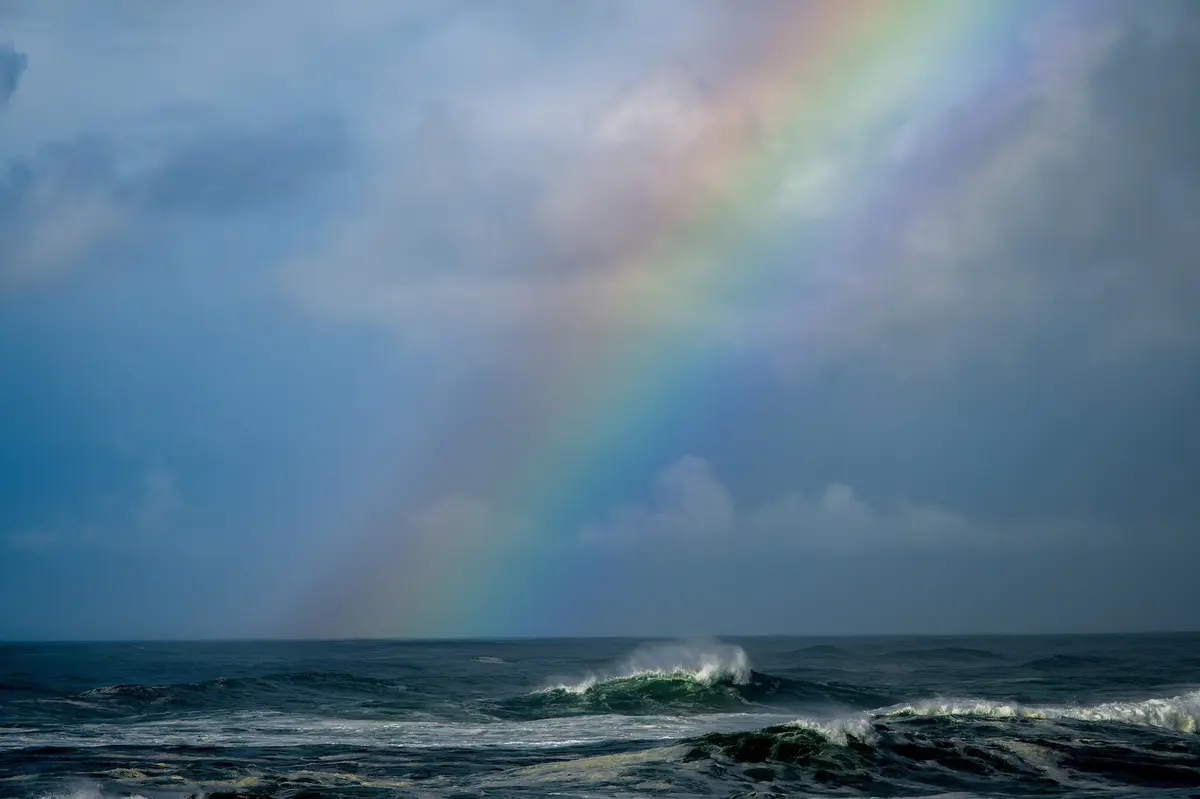
The Pacific at the mouth of the Columbia River, seen from Cape Disappointment, which Lewis and Clark both explored in November 1805.. Jake Bonello / U.S. Fish and Wildlife Service. Clark’s field notesOcian in view! O! the joy.
Everyone votes
The Corps has reached the Pacific. Now it must choose where to winter, and the captains poll the whole party. York, Clark’s enslaved man, casts a vote. So does Sacagawea, whom Clark records as “Janey.” She asks for “a place where there is plenty of Potas,” the wapato roots she knows they can live on. They cross to the south shore, and by Christmas they are under the roof of Fort Clatsop.
Home
The Corps leaves Fort Clatsop on 23 March 1806. Back over the Bitterroots, the captains split up to explore more country. On 25 July Clark carves his name and the date into a sandstone pillar on the Yellowstone. They reunite on the Missouri on 12 August and ride the current down. About noon on 23 September they land at St. Louis and fire a salute. The whole town turns out and gives three cheers.

The Corps

Army captain from Albemarle County, Virginia, and Jefferson’s private secretary. Studied botany, medicine and celestial navigation in Philadelphia before setting out. Filled his journals with the first descriptions of the West’s plants and animals. Became governor of the Louisiana Territory in 1807.

Virginia-born, Kentucky-raised Army officer who led riflemen at Fallen Timbers in 1794. Lewis once served in his company. Ran the boats and drew the maps. By dead reckoning he put the Pacific 4,142 miles from the mouth of the Missouri.

Lemhi Shoshone, about 16 when she joined, carrying her infant son the whole way. Saved papers and instruments from a swamped boat and found her brother’s people when the Corps needed horses. No portrait exists; shown is Leonard Crunelle’s statue.

Pennsylvania carpenter and Army veteran, elected sergeant by the men after Floyd’s death. Led the building of Fort Mandan and Fort Clatsop. Published the first account of the journey in 1807 and died in 1870, the last of the Corps.
By the numbers
In pictures


Watch, listen, see
Films, photographs and first-hand accounts from across the web. Each opens in a new tab.

Episode one of the Ken Burns film on the Corps of Discovery, free to stream.
PBS
The complete Moulton edition of the journals, day by day, with maps and images.
University of Nebraska–LincolnThe full text of the president’s 20 June 1803 instructions for the expedition.
Library of Congress
Jefferson’s confidential January 1803 request for $2,500 to send an officer west.
National Archives
The story of York, who went to the Pacific and back with the Corps.
National Park Service
A trail ranger shows the instruments and methods behind the expedition’s maps.
National Park Service
An online exhibition of the maps, letters and journals that charted the expedition.
Library of Congress
The 4,900-mile national historic trail through 16 states, with maps and places to visit.
National Park Service“Of courage undaunted; possessing a firmness and perseverance of purpose which nothing but impossibilities could divert from its direction.”
Thomas Jefferson on Meriwether Lewis, Monticello, 18 August 1813
After
Congress gave each man double pay and 320 acres of land, and each captain 1,600 acres. Jefferson made Lewis governor of the Louisiana Territory. Clark became the government’s chief Indian agent in the West and governor of Missouri Territory. His 1814 map gave the country its first accurate picture of where the Missouri and the Columbia rise.
York, the one member who was enslaved, received neither pay nor land. Clark freed him years later. In 2001 President Clinton named York and Sacagawea honorary sergeants in the Regular Army and gave Clark the captain’s rank he had held in all but name.
Patrick Gass published the first account of the journey in 1807 and outlived every other member of the Corps. The route they blazed is now the Lewis and Clark National Historic Trail, 4,900 miles through 16 states.